Geographical plots#
See Test2DFunctions
Movable projection of the world#
The Python code for the example below can be found online in the DataXlCalcNet repository or in the corresponding local DataXlCalcNet folder in the file D01_PlotlyGeo_MovableProjection.py, and the XML code in the file D01_PlotlyGeo_MovableProjection.2D.xml.

Rotatable globe#
The Python code for the example below can be found online in the DataXlCalcNet repository or in the corresponding local DataXlCalcNet folder in the file D02_PlotlyGeo_MovableGlobe.py, and the XML code in the file D02_PlotlyGeo_MovableGlobe.2D.xml.

Choropleth of the US with Alaska and Hawai#
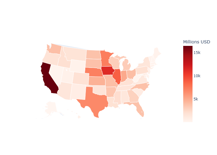
The Python code for the example below can be found online in the DataXlCalcNet repository or in the corresponding local DataXlCalcNet folder in the file D03_PlotlyGeo_USA_Agriculture.py, and the XML code in the file D03_PlotlyGeo_USA_Agriculture.2D.xml.
Voting results embedded in map#
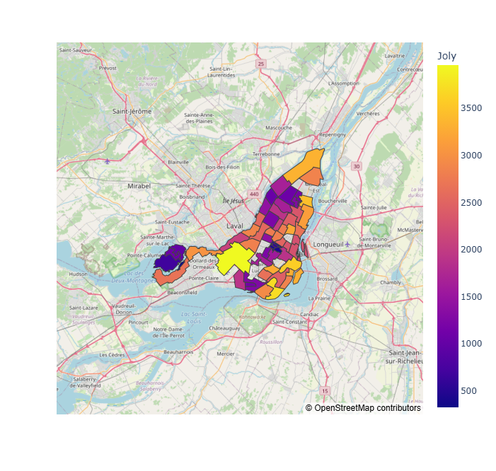
The Python code for the example below can be found online in the DataXlCalcNet repository or in the corresponding local DataXlCalcNet folder in the file D04_PlotlyGeo_MontrealVotingWithMap.py, and the XML code in the file D04_PlotlyGeo_MontrealVotingWithMap.2D.xml.